
Colorado is a state in the western United States, with the Rocky Mountains in the west and the Great Plains in the east. It became the 38th state on 1 August 1876, earning the nickname the Centennial State. Its capital, Denver, is exactly one mile above sea level. Colorado has four national parks and 58 peaks over 14,000 feet.
Colorado quick facts
- Colorado became the 38th state on 1 August 1876.
- Denver is exactly one mile (5,280 feet) above sea level.
- Mount Elbert, the highest point, is 14,440 feet tall.
- Great Sand Dunes has the tallest dunes in North America.
- The name Colorado is Spanish for “coloured red”.
What is Colorado?

Colorado is a state in the western United States, famous for its high, snowy mountains. The Rocky Mountains run through the western half of the state, while wide, flat plains stretch across the east.
Colorado became a state in 1876, and its capital is Denver. It is known for its national parks, its skiing, its giant sand dunes and its ancient cliff houses.
Nearly 6 million people live in Colorado. It is one of the fastest-growing states in the USA.
Colorado fact file
- Capital
- Denver, exactly one mile above sea level
- Largest city
- Denver, which is also the capital
- Population
- 5,773,714 (2020)
- Nickname
- The Centennial State
- Region
- The western United States, with the Rocky Mountains in the west and the Great Plains in the east
- Bordering states
- Wyoming, Nebraska, Kansas, Oklahoma, New Mexico and Utah. It also touches Arizona at the Four Corners
- Statehood date
- 1 August 1876, the 38th state
- State bird
- Lark bunting, since 1931
- State flower
- Rocky Mountain columbine, since 1899
- State animal
- Rocky Mountain bighorn sheep
- Landmarks
- The Rocky Mountains, and four national parks
- Rivers and lakes
- The Colorado River, which starts in Rocky Mountain National Park, and the Gunnison
- Climate
- Mostly dry, with big changes from place to place and from day to night; snowy in the mountains
- Flag
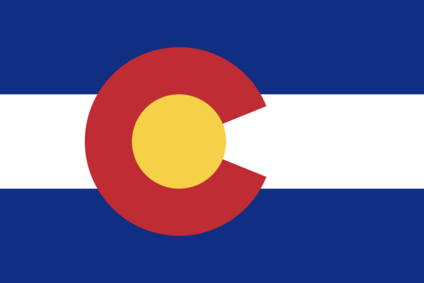
- Blue and white stripes with a red letter C around a gold circle, adopted 5 June 1911
And a few things no report form asks for:
| Total area | 104,094 sq miles (269,601 sq km) |
| Highest point | Mount Elbert, 14,440 feet (4,401 m) |
| Shape | Almost a rectangle: its borders follow lines of latitude and longitude |
Where is Colorado?

Colorado is in the western part of the United States. National Geographic Kids says its neighbours are Wyoming, Nebraska, Kansas, Oklahoma, New Mexico and Utah.
In the south-west corner is a special spot called the Four Corners. It is the only place in the United States where four states meet: Colorado, Utah, Arizona and New Mexico. National Geographic Kids says you can stand in all four states at once.
How big is Colorado?

Colorado is a big state. The US Census Bureau says it covers 104,094 square miles (269,601 sq km). Almost all of that is land, with just 452 square miles of water.
On a map, Colorado is shaped almost like a rectangle, with straight borders on every side. Its borders follow lines of latitude and longitude rather than rivers or mountains.
Mountains and plains

The Rocky Mountains fill western Colorado, and the Great Plains stretch across the east, National Geographic Kids says. So Colorado is not all mountains.
The Continental Divide runs through Colorado along the high peaks. National Geographic Kids explains that rivers on one side flow towards the Pacific Ocean, while rivers on the other side flow towards the Atlantic.
The highest point is Mount Elbert, at 14,440 feet (4,401 m) above sea level. Mountains taller than 14,000 feet are nicknamed “fourteeners”, or 14ers. Colorado.com, the state’s official tourism website, says the Colorado Geological Survey counts 58 of them.
Climbing a 14er can be easy or very hard. Colorado.com says the climbs are graded from Class 1, on marked trails, to Class 4, which is steep and sometimes needs ropes.
High up, the air has less oxygen. Colorado.com says this can cause altitude sickness, with headaches, shortness of breath and tiredness. Colorado.com also says the view from Pikes Peak inspired the famous song “America the Beautiful”.
Rivers
The Colorado River starts its long journey to the sea right here. The National Park Service says its headwaters are in Rocky Mountain National Park, more than 10,000 feet up, on the west side of the Continental Divide. Up there, the river is only a few feet wide and shallow.
The state and the river share a name. Spanish explorers called the river Colorado, meaning “coloured red”, because its muddy water looked red. The Gunnison River, which carved the Black Canyon, is a big river of its own. It flows into the Colorado.
Peaks, Divides and Rivers
- What does the Continental Divide decide?
- A Class 4 climb up a 14er is best described as what?
- Why can people get altitude sickness high in the mountains?
- The view from which mountain inspired the song 'America the Beautiful'?
- Why did Spanish explorers call the river Colorado?
Weather and climate
Colorado is far from any ocean, and its land runs from high plains to tall peaks. So its climate changes a lot from place to place. NOAA says the air is mostly dry, and temperatures can swing widely.
A warm afternoon can turn into a cold night. A short drive up a mountain can take you somewhere much colder. That is partly because Colorado is so high. Its average height is 6,800 feet, the highest of any US state.
Snow in the mountains matters to everyone. When it melts in spring, it fills the rivers that farms and cities use. Dry years can bring drought.
Denver, the Mile High City

Denver is the capital and largest city of Colorado. National Geographic Kids says it sits at 5,280 feet above sea level, which is exactly one mile high.
That is why Denver is nicknamed the Mile High City. It lies where the Great Plains meet the foothills of the Rocky Mountains.
National parks
Colorado has four national parks, Colorado.com says.
Rocky Mountain National Park: the National Park Service says it covers 415 square miles, from mountain meadows to tundra high above the trees. Colorado.com says it has more than 60 peaks above 12,000 feet, about 300 miles of trails and 150 lakes. Its road, Trail Ridge Road, climbs to 12,183 feet, the highest through road in the United States. Elk and mule deer live there.
Great Sand Dunes National Park: the National Park Service says it has the tallest sand dunes in North America. Colorado.com says the tallest, Star Dune, rises 750 feet. In some springs, a stream called Medano Creek flows with waves that you can float on.
Mesa Verde National Park: President Theodore Roosevelt created it on 29 June 1906. The National Park Service says it was the first national park set up to protect cultural heritage.
Black Canyon of the Gunnison National Park: Colorado.com says this canyon is up to 2,722 feet deep and only 40 feet wide at its narrowest point. Its Painted Wall is 2,250 feet tall.
Match the National Park
- Rocky Mountain — Trail Ridge Road climbs to 12,183 feet
- Great Sand Dunes — Medano Creek flows with waves you can float on
- Mesa Verde — The first national park set up to protect cultural heritage
- Black Canyon of the Gunnison — Its Painted Wall is 2,250 feet tall
Homes in the cliffs
Mesa Verde protects the homes of the Ancestral Pueblo people, who lived there for more than 700 years, the National Park Service says.
The park has nearly 5,000 ancient sites, including about 600 cliff dwellings, homes built into hollows in the cliffs. The largest, Cliff Palace, has 150 rooms and 23 round rooms called kivas, and is nearly 800 years old.
The National Park Service says 27 Pueblos and Tribes today have ties to Mesa Verde. It is also a UNESCO World Heritage Site.
Dinosaurs
Colorado is a great place for fossils. The National Park Service says Dinosaur National Monument, which crosses the border between Colorado and Utah, has a cliff wall showing more than 1,500 dinosaur fossils, about 150 million years old.
Colorado even has a state dinosaur. Visit Colorado Springs says the Stegosaurus, with the plates along its back, was made the state fossil in 1982.
Fact or Myth: Cliff Homes and Dinosaurs
- The Ancestral Pueblo people lived at Mesa Verde for more than 700 years.
- Cliff Palace, the largest cliff dwelling, has just 15 rooms.
- A kiva is a round room.
- Dinosaur National Monument lies entirely inside Colorado.
- Colorado's state fossil is the Stegosaurus.
A short history
People have lived in Colorado for a very long time. National Geographic Kids says hunters were there about 15,000 years ago.
Later, the Ancestral Pueblo people built the cliff homes at Mesa Verde. The Ute, Cheyenne and Arapaho peoples also lived in the region.
Spanish explorers arrived in the 1500s. Visit Colorado Springs says the name Colorado comes from the Spanish for “coloured red”, probably after the red rocks and muddy red rivers.
In 1858, gold was discovered at Cherry Creek, National Geographic Kids says, and thousands of settlers rushed to Colorado hoping to get rich.
Colorado became the 38th state on 1 August 1876. That was exactly 100 years after the Declaration of Independence, so Colorado is nicknamed the Centennial State.
Colorado Through Time
- First hunters Hunters live in the land that is now Colorado.
- Cliff homes The Ancestral Pueblo people build homes in the cliffs at Mesa Verde.
- Spanish explorers Explorers from Spain arrive and name the land's red rivers.
- Gold rush Gold is found at Cherry Creek, and thousands of settlers rush in.
- Statehood Colorado becomes the 38th state, 100 years after the Declaration of Independence.
- A park for the past Theodore Roosevelt creates Mesa Verde National Park.
Colorado today
The US Census Bureau says 5,773,714 people lived in Colorado in the 2020 Census. That was about 15% more than in 2010. Colorado was one of only 13 states to grow by 10% or more.
Many people come to Colorado to ski, hike, climb and camp. Its mountains, forests and parks make it one of the most popular outdoor holiday places in the country.
State symbols

Visit Colorado Springs lists Colorado’s official state symbols.
Flag: adopted on 5 June 1911. It has blue and white stripes and a red letter C around a gold circle.
Flower: the Rocky Mountain columbine, chosen in 1899.
Bird: the lark bunting, chosen in 1931.
Tree: the Colorado blue spruce, chosen in 1939.
Animal: the Rocky Mountain bighorn sheep.
Fish: the greenback cutthroat trout, chosen in 1994.
Colorado even has two state songs: “Where the Columbines Grow”, from 1915, and “Rocky Mountain High”, from 2007.
Colorado State Symbols
- Flower — Rocky Mountain columbine
- Bird — Lark bunting
- Tree — Colorado blue spruce
- Animal — Rocky Mountain bighorn sheep
- Fish — Greenback cutthroat trout
Wildlife
Colorado’s mountains, forests and plains are home to many animals. National Geographic Kids says they include mountain lions, beavers, bighorn sheep, prairie dogs, bison and golden eagles. The boreal toad is endangered.
Smaller animals, such as red foxes and raccoons, are common too.
Sand dunes in the mountains
It may seem strange to find giant sand dunes in a mountain state. The National Park Service says Great Sand Dunes National Park has the tallest dunes in North America, in a dunefield of 30 square miles (78 sq km).
Colorado.com says the tallest, Star Dune, rises 750 feet from its base to its top, and High Dune is 650 feet. Altogether, the park holds more than 5 billion cubic metres of sand.
The dunes formed because wind carries sand across the valley and piles it up against the mountains. Year after year, the sand builds into huge hills.
The park is also an International Dark Sky Park, the National Park Service says. There are very few lights nearby, so on clear nights the sky is filled with stars.
Longs Peak and the high country
Rocky Mountain National Park has many high peaks, but only one fourteener. Colorado.com says Longs Peak, at 14,256 feet, is the park’s only peak over 14,000 feet.
The park is full of water too. Colorado.com says it has about 450 miles of streams, fed by melting snow from the mountains.
High up in the park, above where trees can grow, is the alpine tundra. The National Park Service says the park’s habitats range from mountain meadows to this cold, windy tundra, where only small, tough plants survive.
A deep, dark canyon
Black Canyon of the Gunnison is one of the most dramatic places in Colorado. Colorado.com says the canyon is 48 miles long.
Its steep walls are so deep and close together that parts of the canyon stay in shadow for much of the day. That is how the Black Canyon got its name.
Far below, the Gunnison River rushes along the bottom. Over millions of years, the river cut the canyon into the hard rock.
Dunes, Peaks and a Dark Canyon
- How did the giant sand dunes form?
- Why is Great Sand Dunes an International Dark Sky Park?
- What grows on the alpine tundra, above where trees can grow?
- How did the Black Canyon get its name?
- What cut the Black Canyon into the hard rock?
Three things people get wrong
Colorado does not mean “colourful”. It is Spanish for “coloured red”.
Colorado is not all mountains. The flat Great Plains cover the east.
Rocky Mountain National Park has only one 14er. Its only peak over 14,000 feet is Longs Peak.
Did you know? At the Four Corners, you can stand in Colorado, Utah, Arizona and New Mexico at the same time.
Try it
Find the Four Corners on a map of the United States. Which four states meet there?
Knowledge check
Why is Denver called the Mile High City?
Show answer
It sits at 5,280 feet, exactly one mile above sea level.
What is a fourteener?
Show answer
A mountain more than 14,000 feet tall.
Frequently asked questions
What is the capital of Colorado?
Denver is the capital and largest city of Colorado. It sits at 5,280 feet, exactly one mile above sea level.
When did Colorado become a state?
Colorado became the 38th state on 1 August 1876, 100 years after the Declaration of Independence, so it is called the Centennial State.
What is the highest mountain in Colorado?
Mount Elbert is the highest point in Colorado, at 14,440 feet. Colorado has 58 peaks over 14,000 feet, called fourteeners.
What does Colorado mean?
The name Colorado comes from the Spanish for “coloured red”, not “colourful”.
What national parks are in Colorado?
Colorado has four national parks: Rocky Mountain, Great Sand Dunes, Mesa Verde and Black Canyon of the Gunnison.
How many people live in Colorado?
The 2020 Census counted 5,773,714 people in Colorado, about 15% more than in 2010.
Sources
- National Geographic Kids: Colorado — neighbours, the Four Corners, mountains and plains, Denver, history and wildlife
- US Census Bureau: Colorado in the 2020 Census — population and growth
- US Census Bureau: state area measurements — Colorado’s total, land and water area
- National Park Service: Mesa Verde National Park — Mesa Verde’s history, sites and cliff dwellings; its pages on Rocky Mountain, Great Sand Dunes and Dinosaur were also used
- Colorado.com: Colorado’s national parks by the numbers — figures for the four national parks; its page on 14ers was also used
- Visit Colorado Springs: Colorado state symbols — state symbols, the flag, the name and statehood
- National Park Service, Colorado National Monument: the Colorado River’s headwaters in Rocky Mountain National Park, above 10,000 feet and west of the Continental Divide; the Gunnison as a tributary. —
- NOAA NCEI State Climate Summaries: Colorado — varied, semiarid climate, wide temperature swings, 6,800 ft average elevation, snowmelt and drought.
Colorado Facts Quiz
- What covers the eastern part of Colorado?
- Why is Colorado almost a rectangle on a map?
- How much of Colorado's area is water?
- Which record does Colorado hold for its height?
- Why does mountain snow matter to farms and cities?
- Where does Denver lie?
- How tall is Star Dune, the tallest in Great Sand Dunes?
- Which of these is NOT true of Mesa Verde?
- Which Colorado animal does the guide say is endangered?
- Which peak is the only fourteener in Rocky Mountain National Park?
- How many official state songs does Colorado have?


